It's the journey that matters not the destination!
The mountains were calling us last summer and when we sat together to decide the trail for our cycling expedition for 2009, we could not think of a better destination than 'The Nilgiris'. Often referred to as the Nilgiri Hills, the mountain ranges with at least 24 peaks above 2,000 meters (6,562 ft), appears at the juncture of Karnataka, Tamil Nadu and Kerala (states in Southern India). The route (see image above), also called the Green Triangle, starts from Bangalore to Ooty via Mahe. Our goal was to 'GO
THERE - GO GREEN' by cycling to our destination.
THERE - GO GREEN' by cycling to our destination.

| 8 days | 950 KM | Average 120 km per day
| Trek Bikes 3700 |
| Trek Bikes 3700 |
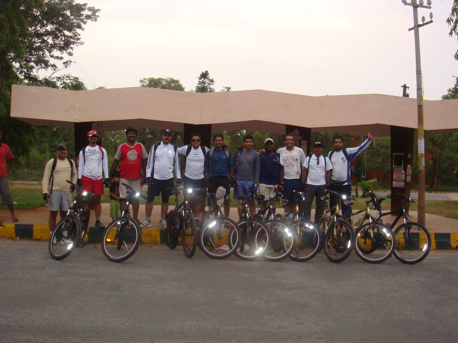
About Us:
Our group, TandemTrails promotes cycling in nature's lap in a sustainable and ethical manner. The logistics of the entire trip was planned, managed and executed by the team. The entire trip was self-sponsored and self cycled.
A Trip with a Mission
The plan was to cycle through the Green Triangle while exploring the greenery, the villages and our country side to feel the true essence of nature. We also doubled as messengers with a mission as we distributed literatures across villages in support of 'Save the Girl child' campaign. The idea was to try and create more awareness against inhuman practices against women such as female foeticide, social discrimination and female illiteracy.
The Route
Bangalore, Mahe & Ooty formed the vertices of our Green Triangle. En route Mahe we passed through Savandurga, Nagamangala, Kushalanagar, Virajpet and Parambadi. The descent from Parambadi to Mahe was a muddy trail, putting our 'Mountain Terrain Bikes' to some test. Even if our bikes gave up in certain terrains our sprits didn't. We pushed them as we pushed ourselves.
"There is always Music amongst the trees in the Garden, but our hearts must be very quiet to hear it."
This is what we felt when we cycled through serene forest of Mahe, Nadapuram, Vythri and Gudular. The humming birds drew us to Ooty where we could hear every sound of nature clearly. The ascent to Vythri through Ooty tested our mental and physical endurance at every hairpin bend. It was in these stretches that we were reminded that "CYCLING IS ALL ABOUT THE MIND".
Gravity tested our brakes while descending from Ooty to Mudhumalai. Traversing through the pristine jungles of Bandipur, with a herd of deer crossing our tracks, was a spellbinding experience. Mysore to Bangalore was a CakeRide (A new term coined by us as a Nilgiri's cake awaited us in Bangalore – we cycled faster and covered the distance less than 7 hours timeJ).

Villager's comments (read kids) J
- 'Why didn't you take the bus instead?'
- 'Didn't you have money to come by bus?'
- 'Is this an offering to God in exchange of a wealthy life?'
- On seeing our electrolyte bottles: 'Look! that bottle has petrol….. And this cycle runs on motor!' J
- On us looking being tired: 'Do you need help…. Shall we push?'
TandemTrails as a group would like to convert 500 motorists to active cycling by 2010 December, normally all our cars emits minimum 100 gm of Co2 / every km run, so the lesser we use them the better. 350 parts per million is the safe limit of Co2 in the atmosphere, we are currently at 387 PPM (source: 350.org). Think about it next time when u want to drive to your neighborhood store !
Team's significant previous Trails:
2007 – Manali to Leh (Passing Rohtang, Baralacha-La, Nakeela, Lunchlung-La, TangLang-La) & Kurdung-La (Worlds Highest Motorable Road)
2008 - Shimla to Manali through Spiti Valley (Passing Kunzum-La and Rohtang Pass)
THE GREEN TRIANGLE
Route highlights:
24th May = Route: Bangalore to Nagamangala, Total distance: 117 kms, Altitude difference: +160 mts
25th May = Route: Nagamangala to Kushalnagar, Total distance: 122 kms, Altitude difference: +50 mts
26th May = Route: Kushalnagar to Kunnur, Total distance: 126 kms, Altitude difference: -840 mts
27th May = Route: Kunnur to Vaythri, Total distance: 109 kms, Altitude difference: +740 mts
28th May = Day off :-)
29th May = Route: Vaythri to Ooty, Total distance: 100 kms, Altitude difference: +1570 mts
30th May = Route: Ooty to Sivanasamudram, Total distance: 154 kms, Altitude difference: -1650 mts
31st May = Route: Sivanasamudram to Bangalore, Total distance: 120 kms, Altitude difference: +300 mts
Bangalore -> Magadi -> Thatavalu -> Agalakote -> Bydarahalli -> Chowdanakuppe -> Shringarasagra -> Yadavanne -> Devalapura -> Nagamangala -> Jaginakere -> AgraharaBachahalli -> Krishanarajpet -> Bommenahalli -> Bherya -> Saligrama -> Ballur -> Hadya -> Kithoor -> Attigodu -> Bettadapura -> Tharikal -> Avarthi-> Koppa - Kushalnagar -> Virajpet -> Keezhur -> Keezhallur -> Kanhirode -> Elayavoor -> Kannur -> Thalassery -> Mahe -> Thuneri -> Nadapuram -> Velom -> Vellamunda -> Vengappaly -> Vaythri -> Muppainad -> Nilleyalam -> Gudalur -> Pykara -> Ooty -> Bandipur-> Gundlupet -> Chamarajnagar -> Kollegal -> Shivanasamudram -> Netkal -> Thorekadanahalli -> Kanakapura -> Bangalore
DAY-1
DAY-2
DAY-3
DAY-4, 5
DAY-6
DAY-7
DAY-8